
Laser Scanning for Architecture & Design Firms
Accurate Existing Conditions for Faster, More Confident Design
Start design with reliable building data. Sentinel Scanning captures precise existing conditions to support renovations, coordination, and BIM workflows.
Typical response within 1 business dayMillimeter-level accuracy
Revit models
up to LOD 500
Trusted by professionals
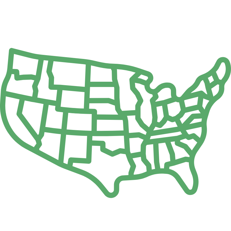
Nationwide coverage

INDUSTRY APPLICATION
Designed for Architectural Projects Where Accurate Existing Conditions Are Critical
Architecture firms rely on accurate existing conditions documentation when planning renovations, adaptive reuse projects, and tenant improvements. Outdated drawings and incomplete documentation can slow design development and introduce risk during construction.
✓ Renovations and adaptive reuse projects
✓ Outdated or missing building documentation
✓ Coordination across architectural, structural, and MEP teams
✓ Revit and BIM workflows requiring accurate base data
✓ Reducing site visits and field verification time

COMMON CHALLENGES
When Existing Conditions Are Inaccurate, Projects Slow Down
Outdated drawings and incomplete documentation force design teams to spend time verifying conditions instead of moving projects forward.
✓ Drawings no longer reflect actual building conditions
✓ Time lost verifying measurements in the field
✓ Coordination issues between architectural, structural, and MEP teams
✓ Unexpected conflicts discovered during construction
These issues introduce risk early in the project and often lead to delays, redesign, and additional cost.
HOW SENTINEL SCANNING HELPS
Accurate Data from the Start Changes the Entire Design Process
Sentinel Scanning captures highly accurate existing conditions, allowing architecture teams to begin design with reliable building data instead of assumptions.
-
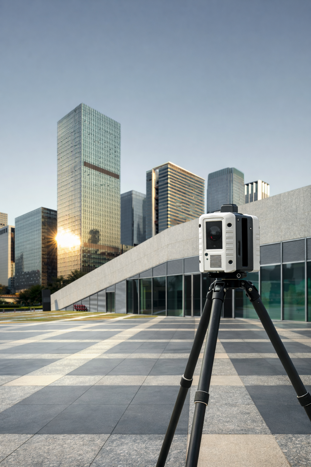
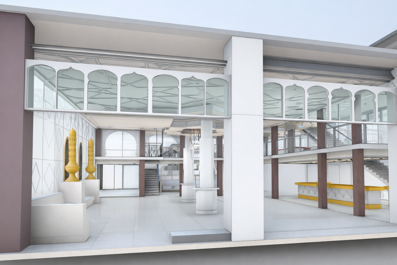
Sentinel Scanning provides architecture firms with precise digital building documentation that supports both design development and coordination between project disciplines. Using advanced laser scanning technology, millions of measurement points are captured across every visible surface of the structure.
-
These measurements are combined to create a highly detailed digital dataset known as a point cloud, which represents the building’s geometry with exceptional accuracy. Architects and engineers can reference this dataset to verify dimensions, analyze spatial relationships, and understand the existing structure before design work begins.
-
This accurate data supports Scan-to-BIM workflows, allowing design teams to incorporate existing conditions directly into their digital models. Revit models derived from scan data enable architects to work within familiar BIM environments while referencing precise building geometry.
-
Accurate existing conditions data allows architectural, structural, and MEP teams to work from a shared understanding of the building. By referencing the same point cloud or BIM model, project teams can align their designs, identify potential conflicts early, and coordinate systems more effectively before construction begins.
-
With reliable scan data available, architects can reduce the need for repeated site visits and focus more time on design development. Consultants across multiple disciplines can coordinate their work using the same accurate building documentation.
DELIVERABLES
Deliverables That Fit Your Design and BIM Workflow
Sentinel Scanning provides documentation that integrates directly into architectural and BIM workflows.
All deliverables are tailored to your project scope and level of detail requirements.
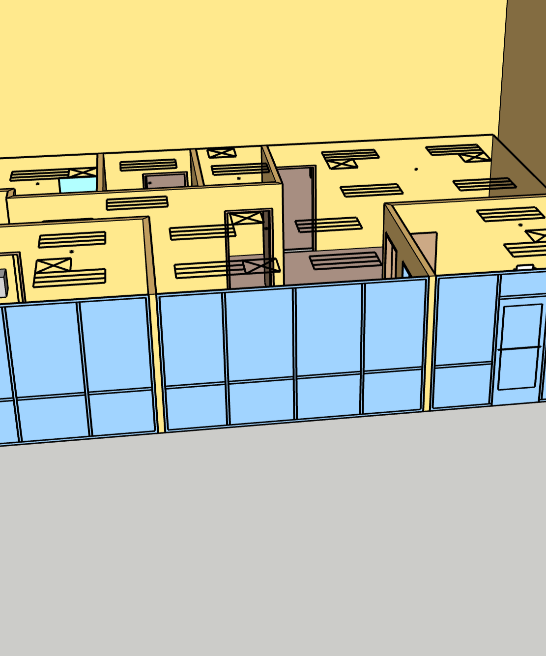
Revit Models
(LOD 200–500)
BIM-ready models developed from scan data, allowing teams to design within accurate existing conditions.
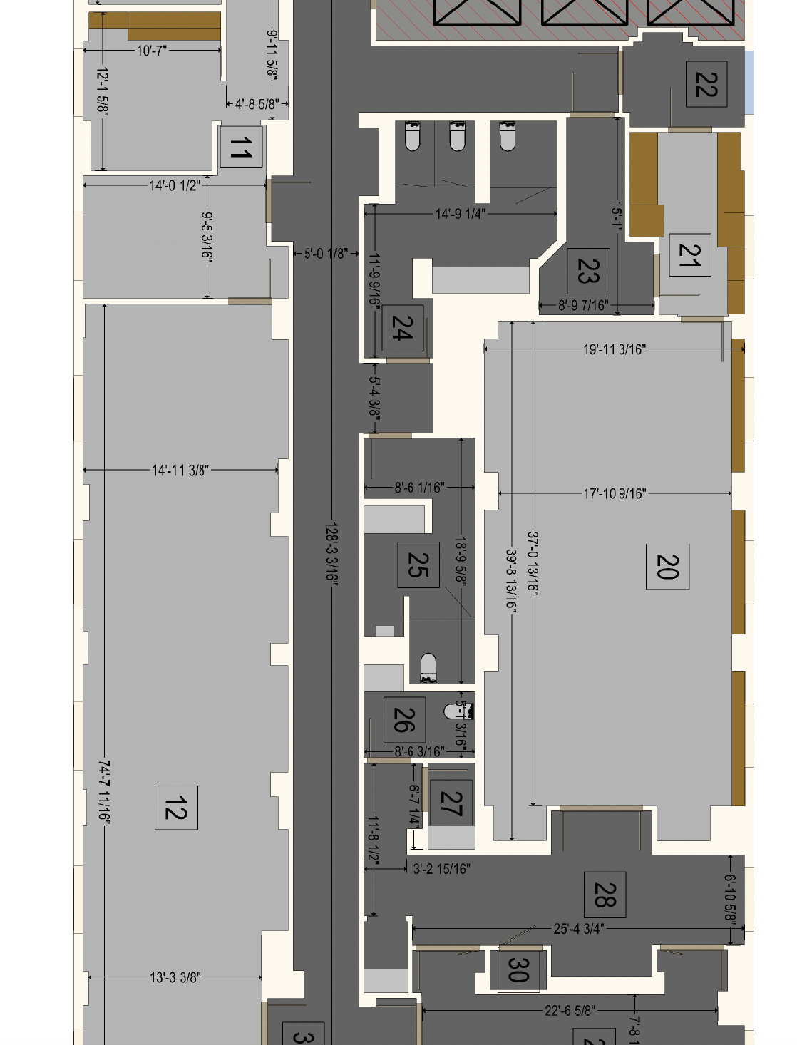
2D Floor Plans & Measured Drawings
Accurate plans to support layout development, documentation, and renovation planning.
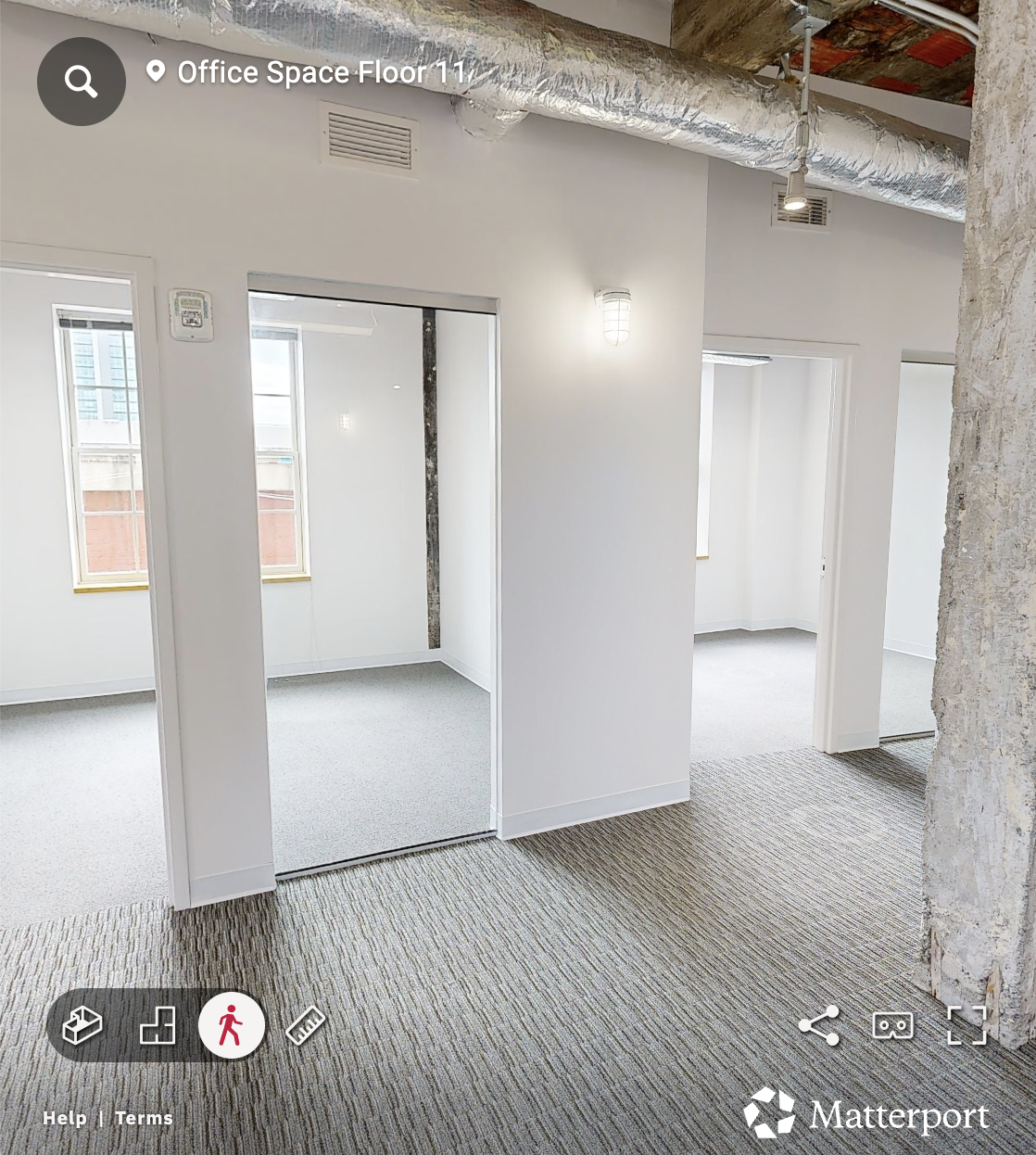
Matterport Virtual Walkthroughs
Immersive digital twins enabling remote site understanding and collaboration.
Interactive 3D PDFs
Accessible visualizations that allow project teams to explore the building without specialized software.
GET A QUOTE
Get Accurate Existing Conditions for Your Next Project
Tell us about your project scope, timeline, and deliverables, and we’ll provide a clear proposal tailored to your needs.
Typical response within 1 business day